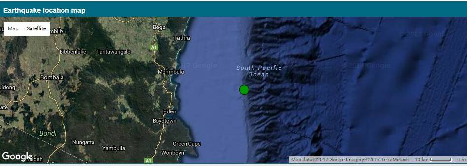
Geoscience Australia has reported that there was a 3.4 magnitude earthquake off the coast of Merimbula in the early hours of Monday morning.
Subscribe now for unlimited access.
$0/
(min cost $0)
or signup to continue reading
The quake occurred at 2.16am local time on Monday, November 20 about 30-35kms east of Merimbula and about 10km south. The actual co-ordinates of the quake have been given as 36.969, 150.315.
Geoscience Australia said estimated that this earthquake “could have been felt by people up to 34km away”.
Geoscience Australia duty seismologist Dan Connolly said the earthquake was at a depth of 10km which was considered “quite shallow”.
“The historic trends for the area are quite interesting. There have been 59 earthquakes within 100km of this area in the last 30 years but 37 of them have occurred in the last seven years,” Mr Connolly said.
However no conclusions could be drawn from these figures he said.
“We tend to look at things in terms of human lifetimes but in fact these events should be considered in the earth’s lifetime and therefore don’t really mean that much.
“It could simply be nothing more than better technology to register them,” he added.
“But it does show how unpredictable this planet can be.”
Mr Connolly said that the area was prone to the smaller 2-3 magnitude earthquakes.
He explained that there are a number of faults in the wider area such as around Moe, Victoria, Jindabyne, the alps, going through towards Canberra and then Sydney.
Mr Connolly said that earthquakes can occur a long way from fault line though.
Geoscience Australia did not receive any reports of the earthquake off Merimbula but would be very interested to hear from anyone who felt it. You can contact them at their website www.ga.gov.au.
The severity of shaking during an earthquake is affected by factors such as the depth of the earthquake, local geology and soil conditions.

